
**Categories:** News, Mining **Tags:** DRC, geological mapping, exploration, minerals, mining data **Excerpt:** The DRC is launching airborne geological surveys intended to increase geoscientific coverage from 22.27% to 46.1%. By reducing uncertainty about resources, Kinshasa hopes to attract exploration to poorly documented areas and strengthen its control over mining data. **Slug:** rdc-cartographie-geologique-aerienne-potentiel-minier **Image alt:** Geophysical survey aircraft flying over a forested mining area in the Democratic Republic of the Congo.
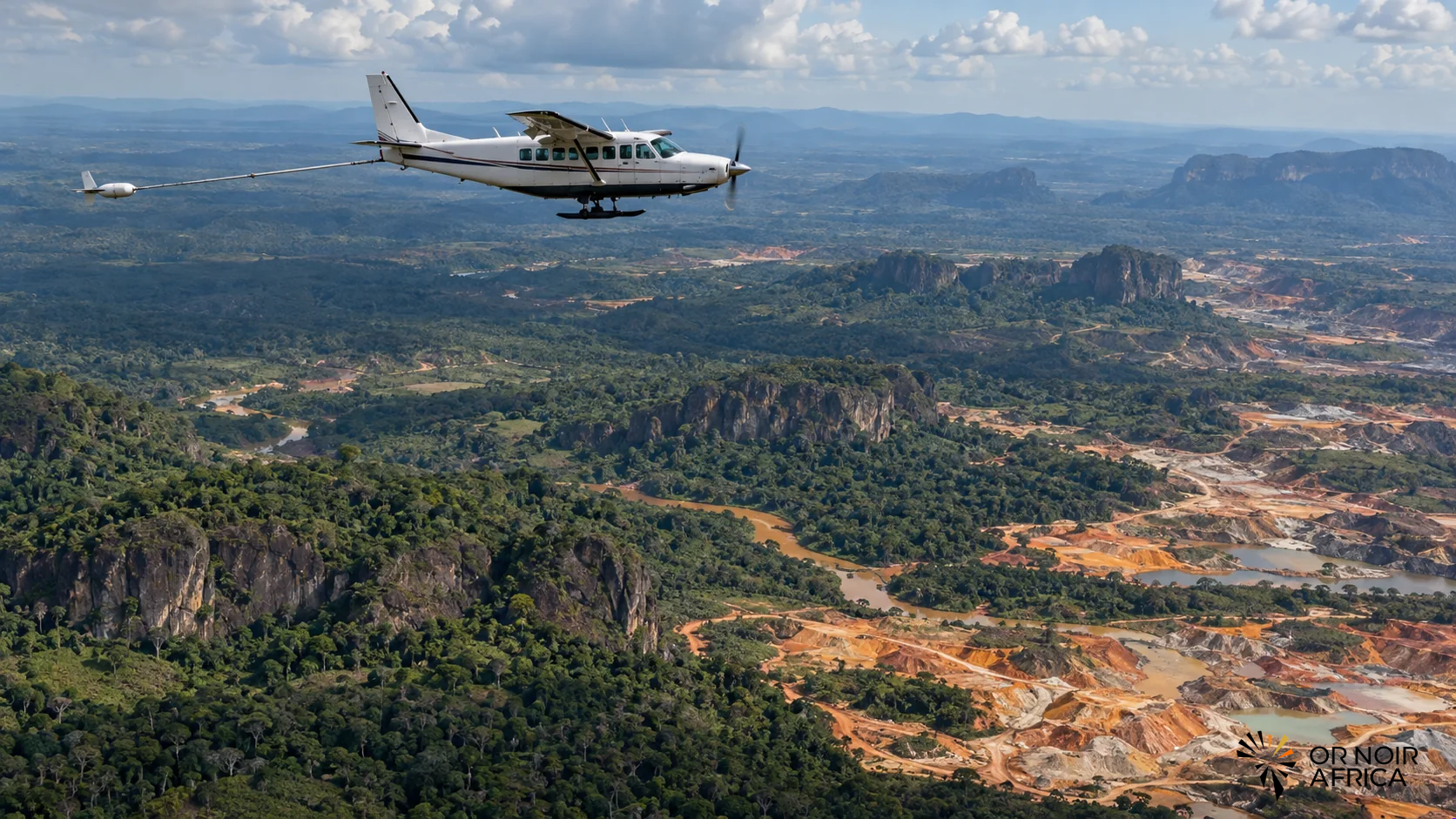
The Democratic Republic of the Congo is launching an airborne geological mapping program to document its subsurface more effectively and attract exploration to regions that remain poorly studied. The government wants to increase the country’s geoscientific coverage from 22.27% to 46.1%, according to Mines Minister Louis Watum Kabamba at the program’s launch on October 6.
The aim is to reduce the information deficit that increases exploration costs and risks. Airborne surveys can collect data on geological structures and mineral anomalies over large areas. They provide authorities and companies with a more consistent information base for targeting future field campaigns, without replacing drilling or the detailed studies needed to confirm a deposit.
Data as mining infrastructure
A reliable geological map helps guide investment. Exploration companies devote substantial resources to subsurface analysis before deciding where to undertake expensive work. When an area has little data, uncertainty can discourage capital or extend preliminary stages. High-quality public information can help compare areas, attract applicants and improve permitting decisions.
Mapping also strengthens the state’s ability to understand and manage its resources. Geological data is strategic: it informs mining planning, rights negotiations and infrastructure development. The Congolese government is seeking greater control over information supporting discoveries and future projects, as it aims to capture a larger share of the sector’s value.
This ambition raises a governance question: who can access the data, under what conditions and at what cost? Excessively restricted access can slow exploration and reduce competition among investors. Conversely, clear disclosure rules, with reasonable confidentiality periods for companies that funded work, can encourage investment while protecting the public interest.
From coverage to exploration
The 46.1% target represents a substantial increase but leaves more than half the territory outside the intended geoscientific coverage. The program will need to specify priority areas, methods and the schedule for publishing results. Quality will depend on data resolution, integration with existing surveys and geological services’ ability to interpret the information.
The DRC has substantial resources of copper, cobalt, lithium, tin, gold and other minerals. These resources are not all understood to the same degree and cannot necessarily be exploited under the same conditions. Geophysical data can reveal targets, but exploration must confirm geology and assess grade, accessibility, energy requirements and potential impacts.
Opening new areas to exploration also requires environmental and social rules. Field campaigns can affect communities, forests and local land uses. Transparent mapping must incorporate local knowledge and respect consultation procedures. Exploration must remain distinct from extraction: discovering a mineral anomaly does not constitute authorization for a mine.
Turning information into responsible investment
To attract companies, the DRC must combine geological data with a clear regulatory framework, effective permitting procedures and investment security guarantees. Projects are more likely to progress when information access rules, work obligations and local content requirements are published and applied consistently.
Mining companies can help complete the data by sharing their work’s results after legally prescribed confidentiality periods. Cooperation among the state, universities and exploration companies would help strengthen local skills in geology, remote sensing and database management.
Success indicators will extend beyond the coverage target. The number of areas actually surveyed, published data, permits awarded in new regions, field campaigns conducted and confirmed discoveries will need to be tracked. Job quality and participation by Congolese institutions will also matter.
Airborne mapping is an investment in subsurface knowledge and the country’s bargaining capacity. It can reduce uncertainty and broaden investor interest, but does not create new deposits or economic value on its own. The next step will be to turn the data into responsible exploration, accessible information and projects that contribute to the country’s development.
Have any thoughts?
Share your reaction or leave a quick response — we’d love to hear what you think!
-
 0
-
0
-
0
-
0
-
0
-
0